Precision Reality Capture & Scan-to-BIM
Eliminate Unforeseen Conditions with Survey-Grade 3D Laser Scanning
Eliminate Unforeseen Conditions with Survey-Grade 3D Laser Scanning
Eliminate Unforeseen Conditions with Survey-Grade 3D Laser Scanning
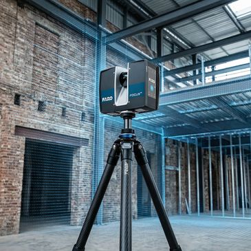
Unforeseen site conditions are one of the leading causes of construction delays and cost overruns. HERNEZ DESIGN captures existing buildings with millimeter-level accuracy using Faro Focus LiDAR scanners, giving architects and contractors a verified, survey-grade model of reality before a single wall is touched.
Your Scan Data, Delivered in Any Industry Format
Eliminate Unforeseen Conditions with Survey-Grade 3D Laser Scanning
Eliminate Unforeseen Conditions with Survey-Grade 3D Laser Scanning
You receive a complete, verified 3D dataset of your site — ready for immediate use in Revit, AutoCAD, Navisworks, and more. We deliver in RCS, RCP, FLS, E57, LAS, PTS, and other popular formats to fit your workflow. Serving architects, designers, and contractors across all of Ontario.
Our Technology: Precision at the Speed of Light

HARDWARE AND SOFTWARE
- Primary Hardware: Faro Focus M-Series Laser Scanners
- Range & Speed: High-speed phase-shift LiDAR technology capable of capturing millions of points per second with a range of up to 70 meters.
- Precision: Millimeter-level accuracy (up to ±3mm) ensuring that even the most complex heritage moldings or structural steel deviations are captured flawlessly.
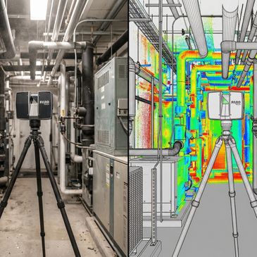
- HDR Imaging: Integrated coaxial HDR camera for photorealistic, high-contrast color overlays on your point clouds, essential for remote site inspections.
- Durability: IP54-rated for reliable performance on active, dusty construction sites and in variable Ontario/New York weather conditions.
- Processing Power: FARO SCENE & Revit Integration
- Registration: We utilize FARO SCENE for advanced point cloud registration (Target-based and Cloud-to-Cloud), ensuring zero-drift across large-scale floor plans.
- Automated Filtering: SCENE’s advanced algorithms allow us to "clean" the data—removing moving objects and noise—to provide you with a crisp, usable model.
- Interoperability: Seamless export to .RCP, .RCS, and .E57 formats for immediate use in Autodesk Revit, AutoCAD, and Navisworks.
Our Technology Partners


